Challenge
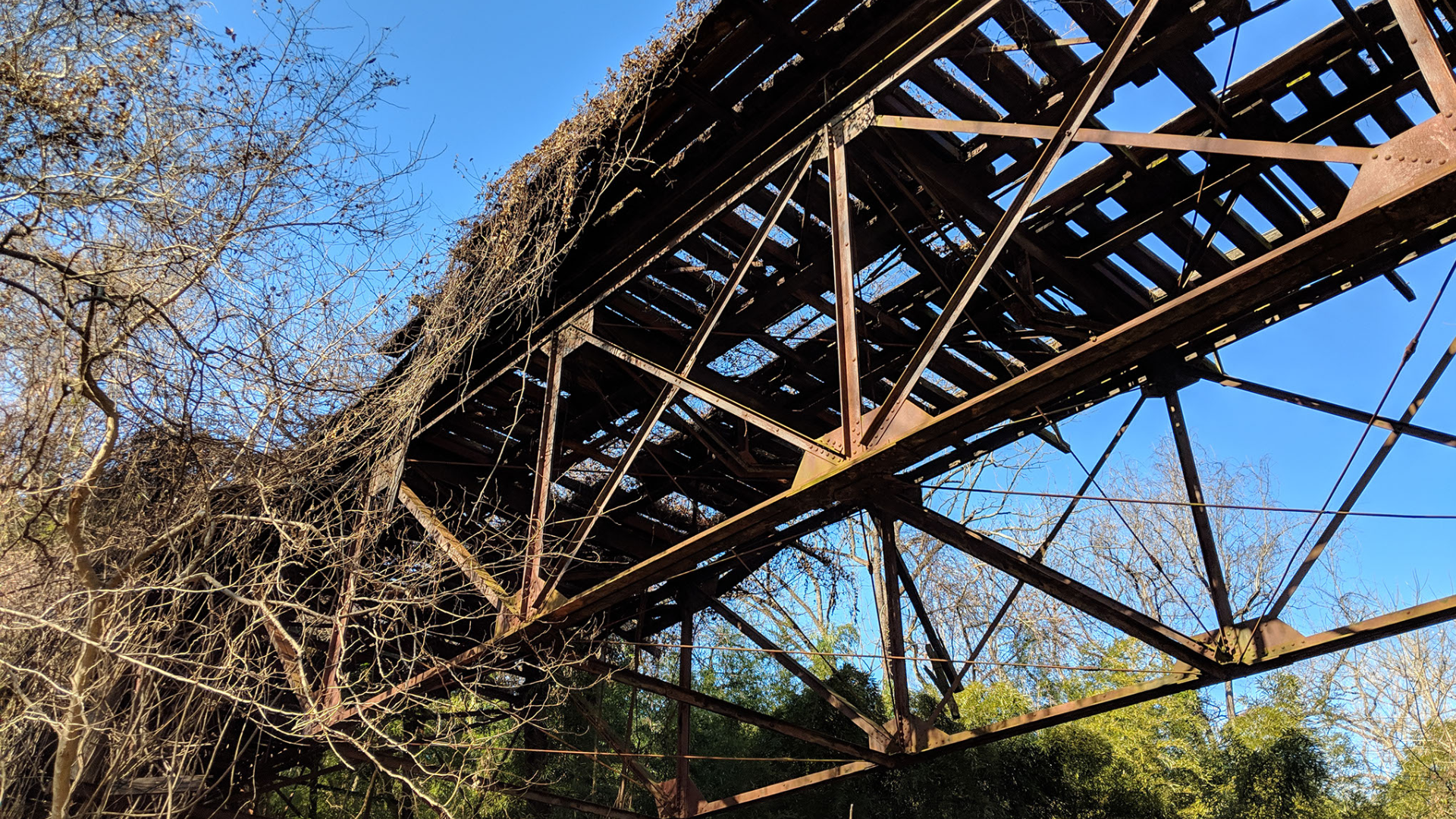
The Palisades Trolley Trail is located along the District Department of Transportation (DDOT) owned Right-of-Way (ROW) of the former Glen Echo Trolley Line northwest of Georgetown. The ROW has operated as an informal and disconnected walking trail behind homes in Palisades and Foxhall. The one remaining trolley bridge, the Foundry Branch Trolley Trestle Bridge, is a contributing resource in the historic Glover-Archbold Park and is in danger of collapse. In 2018, concerns by historic preservation and other groups about the potential demolition of the bridge led DDOT to undertake a study to determine whether the Foundry Branch Trolley Trestle Bridge could be repurposed into a bicycle-pedestrian bridge as part of a connected multi-use trail as proposed in moveDC, DDOT’s long-range transportation plan.
Solution
Kittelson assembled a consultant team to evaluate the issues and challenges in developing a multi-use trail throughout the study area. The consultant team completed topographic, utility, and field surveys of the trail area, conducted a pre- National Environmental Policy Act evaluation of trail impacts, engaged key stakeholders via inter-agency meetings, and completed a 3D laser scan of the Foundry Branch Trestle Bridge to evaluate structural issues associated with rehabilitating the bridge for bicycle and pedestrian use. Kittelson developed detailed concept designs for the proposed trail corridor, including a series of trail alignment alternatives to address topography, ROW, and connectivity barriers throughout the study area. Public outreach was a critical component of the project due to the proximity of the trail to existing homes and subsequent vocal community opposition to a formalized trail on the former trolley line.
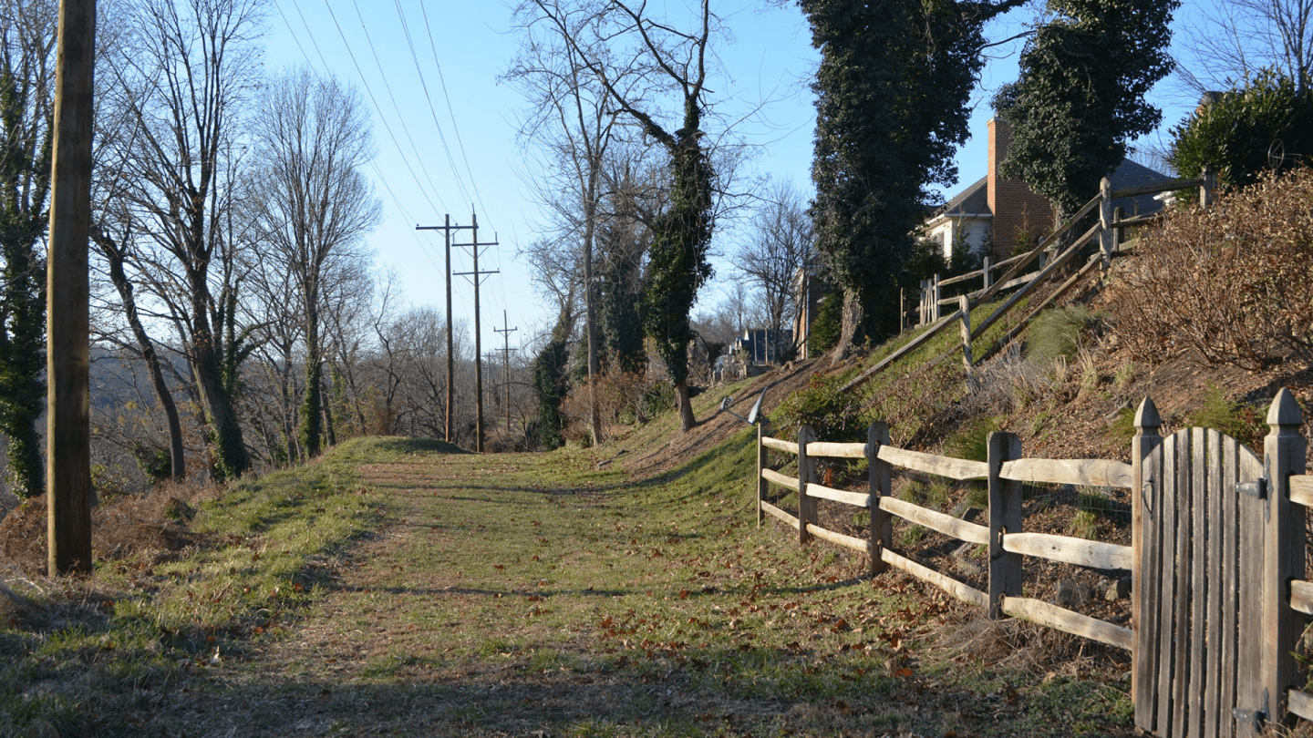
Existing trail condition
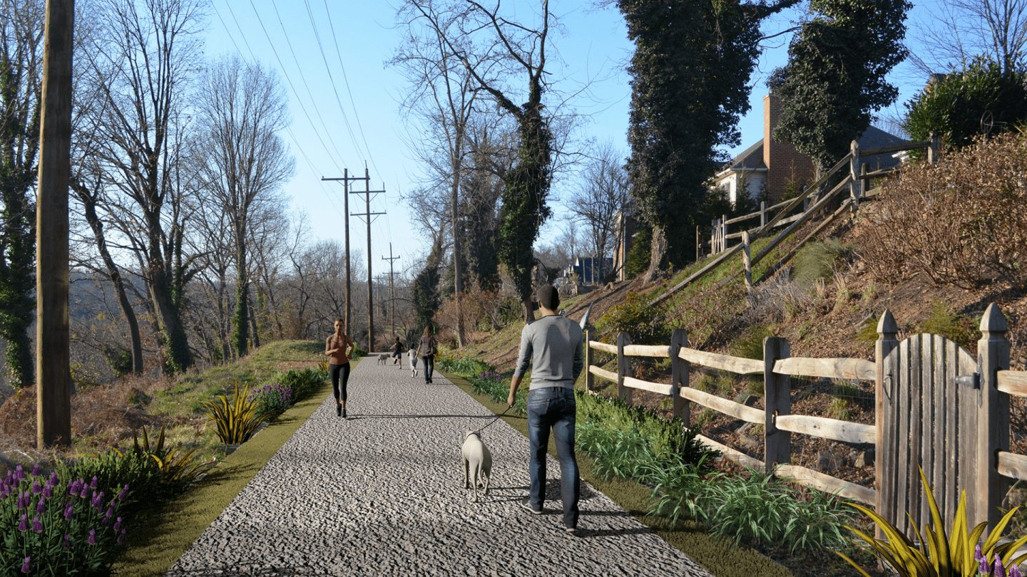
Rendering depicting proposed trail
The Outcome
Learning If a Trail is "Feasible": and If the Community Wants It
Kittelson provided DDOT with a comprehensive analysis of the issues and opportunities associated with constructing a trail in four-phased projects throughout the study area. The study identified many constraints associated with the trail’s full build-out, including high costs, a complex environmental permitting process with multiple property owners, and community opposition. This analysis helped DDOT determine that the full trail alignment’s construction was infeasible, and allowed DDOT to focus on advancing viable segments of the trail that would advance connectivity at a much lower cost, including connections to the parallel Capital Crescent Trail.

