July 23, 2024
Welcome Player 1 👾
In the ever-evolving landscape of transportation planning, three-dimensional (3D) visualization has emerged as a transformative tool capable of harnessing the power of gaming technology to create interactive and immersive simulations. This cutting-edge technology is not just about creating visually appealing models; it’s about transforming how we design, analyze, and communicate complex transportation projects.
🎮 Level 1: What Is 3D Visualization?
3D visualization is the digital representation of a three-dimensional object or environment. It involves creating several digital 3D shapes and combining them to form a virtual scene that includes textures, colors, lighting, motion, and environmental effects. This process allows for the creation of compelling visual narratives that closely mimic real-world scenarios, aiding in communication and decision-making.
3D visualization spans various fields, including architecture, civil engineering, interior design, medical visualization, product design advertising, and gaming. Some forms of 3D visualizations use the same development tools as video games to create more immersive experiences. Using this kind of gaming technology has revolutionized the way we approach and develop simulations for transportation projects. In transportation, it is particularly valuable for simulating transportation infrastructure improvements and presenting “before–and–after” scenarios. 3D visualizations can include animated elements, such as vehicles and pedestrians, to demonstrate real-world scenarios and the potential impacts of different design alternatives to the intersection or roadway.
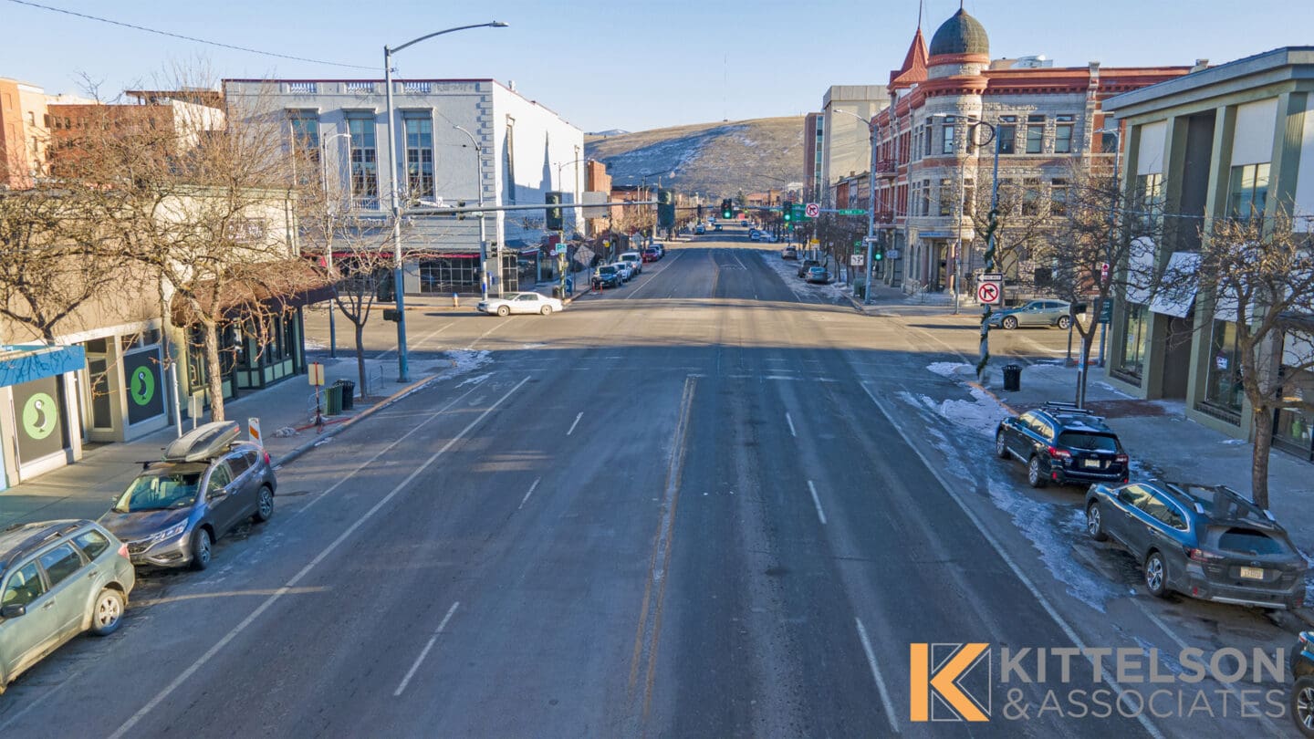
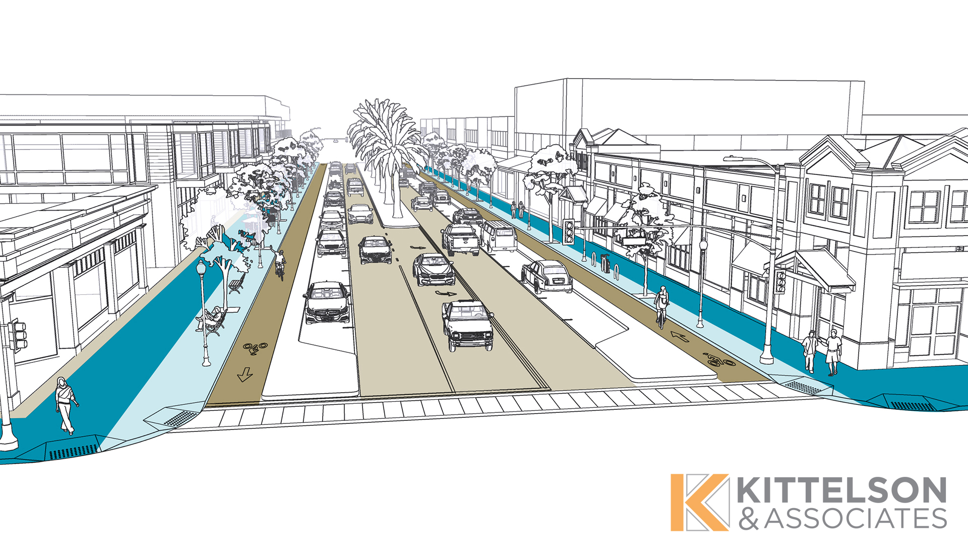
Photo Simulation: Before
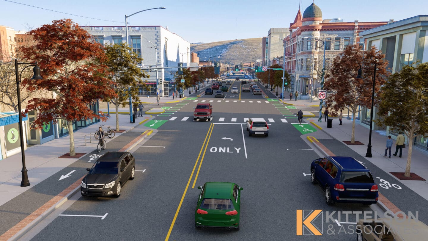
Photo Simulation: After
🎮 Level 2: Public Engagement Power-Up
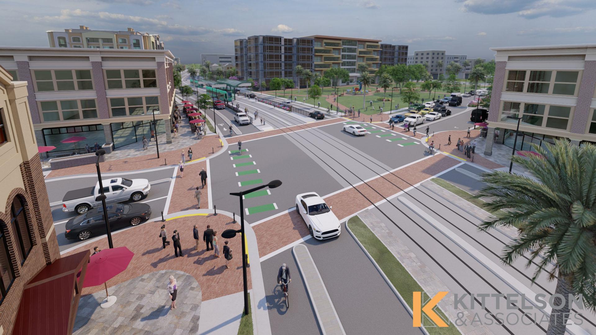
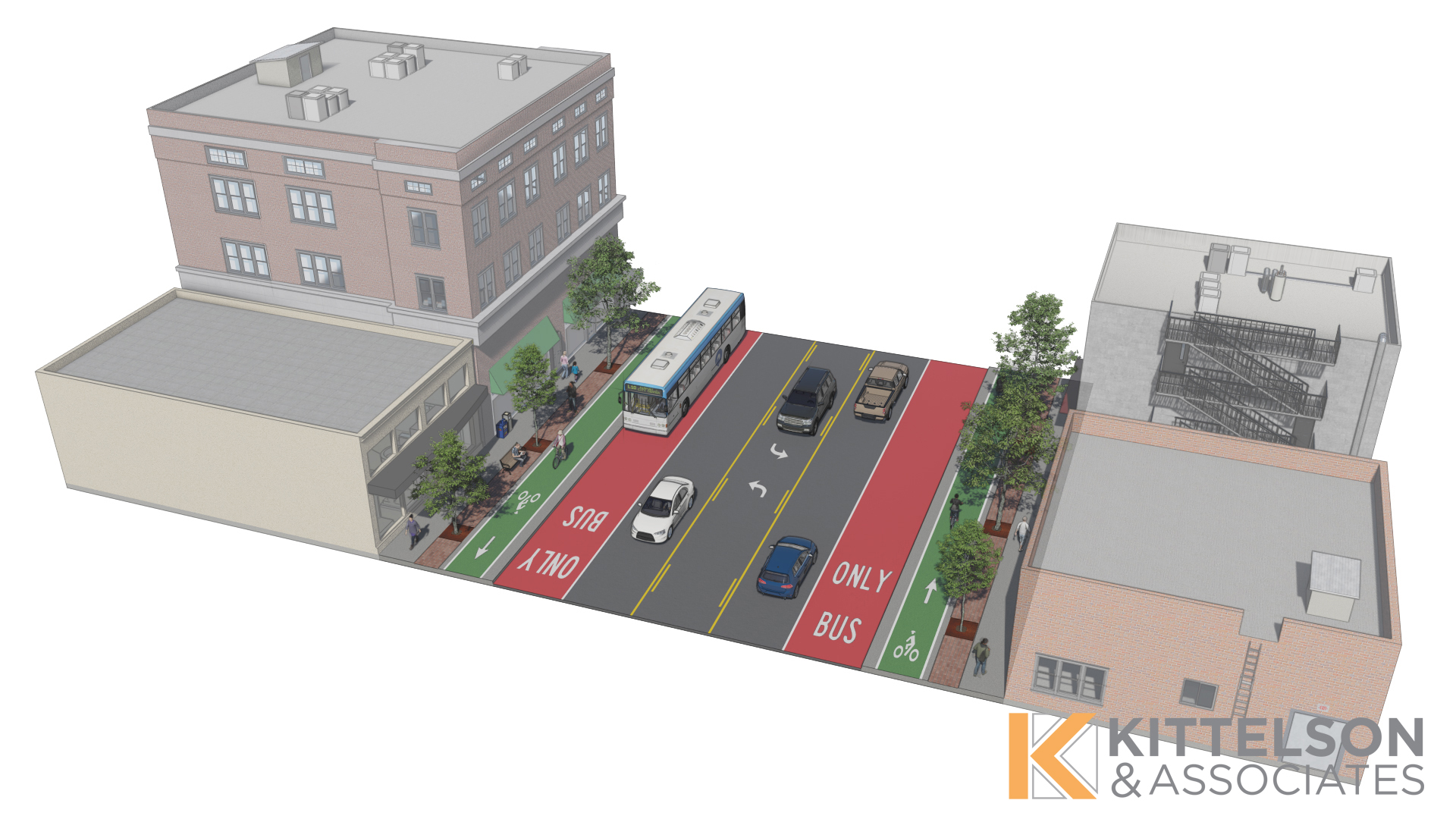
Using 3D visualization technology in transportation projects enhances the design and planning processes. By creating realistic, renderings of proposed changes, transportation designers, planners, clients, and the public can identify potential issues and compare alternatives before implementation. For example, incorporating different vehicle types into a roundabout simulation can reveal how the design would (or would not) accommodate varying sizes and types of vehicles, and therefore how to better ensure safety and efficiency for people driving, walking, or taking transit. This proactive approach helps to refine designs to mitigate unforeseen challenges that might arise from complex situations.
This technology opens up a multitude of new ways for transportation professionals to present and interact with visual data. These technologies enable stakeholders to not only view but also interact with 3D visualizations, offering a more comprehensive and immersive experience. Allowing users to virtually walk or drive through the proposed design offers a new level of experience beyond pre-defined experiences. This realistic representation is especially useful with public engagement, as it helps the non-engineering public grasp the nuances of proposed designs. One of the most compelling aspects of 3D visualization is its ability to inform design decisions. Once stakeholders see visualizations, they often gain new insights and perspectives that were not evident in earlier stages. The realistic portrayal of the project can inspire questions and prompt stakeholders to suggest design modifications that better meet their needs and expectations.
3D visualizations helped us to communicate the intricacies of a roundabout project we worked on at Conrad & 2nd Street in Kalispell, Montana. The roundabout design faced unique challenges due to the hilly terrain of the street segment and concerns about drivers’ ability to see pedestrians with the new design. Our team developed a 3D visualization to address the community’s key concerns, including a view from the driver’s perspective. This visualization enabled the community to see the new design and experience firsthand how easily a driver could spot oncoming traffic and pedestrians. The video animation played a crucial role in demonstrating solutions that a 2D plan could not convey. We shared the video animation with the community through the public involvement website.
3D visualizations can also “power up” public engagement efforts centered around pedestrians and other vulnerable users. While working to connect people who walk and bike along the Highway 99 corridor in downtown Oregon City, we developed several complex design alternatives, including bridge structures and a floating path on the Willamette River. An interactive 3D visualization was created to showcase these options, allowing viewers to switch between alternatives and explore the designs from all perspectives. Before using 3D visualization to showcase options for the project, the proposed design alternatives were facing challenges due to its complex construction. The interactive 3D visualization helped overcome the construction concerns because the 3D scenarios allowed viewers to freely navigate the scene and see perspectives that could not be created in a 2D layout. The 3D scene also helped demonstrate visual aesthetics and displayed how the project would fit within the existing environment. This project demonstrates how visualization tools can enhance understanding, foster stakeholder support, and drive projects forward. The use of gaming technology and 3D visualization in projects creates transparency for projects, giving the ability for the public to see a potential project from their own perspective and ask about their concerns.
Of course, this technology comes with its challenges. The use of this technology requires a high level of detail and accuracy in modeling. A flawed model runs the risk of shattering the illusion for users or even confusing them, which might ultimately distance them further from the proposed design. Also, while 3D visualizations are engaging for more tech-savvy users, they may present a frustrating barrier for older individuals or those unfamiliar with 3D gaming environments. Finding ways to ensure the technology is user-friendly and accessible to everyone is essential for it to effectively engage with the public.
3D visualization in transportation is all about effectively communicating complex changes and improvements. It tells a compelling story about the project in a clear and concise manner. 3D visualization is persuasive because it grants the user the ability to experience the benefits of a project before its built, demystifying the unknowns of a project and making the user more likely to understand (and support) the project’s impact in the physical world.
🎮 Level 3: Advancements in 3D Visualization
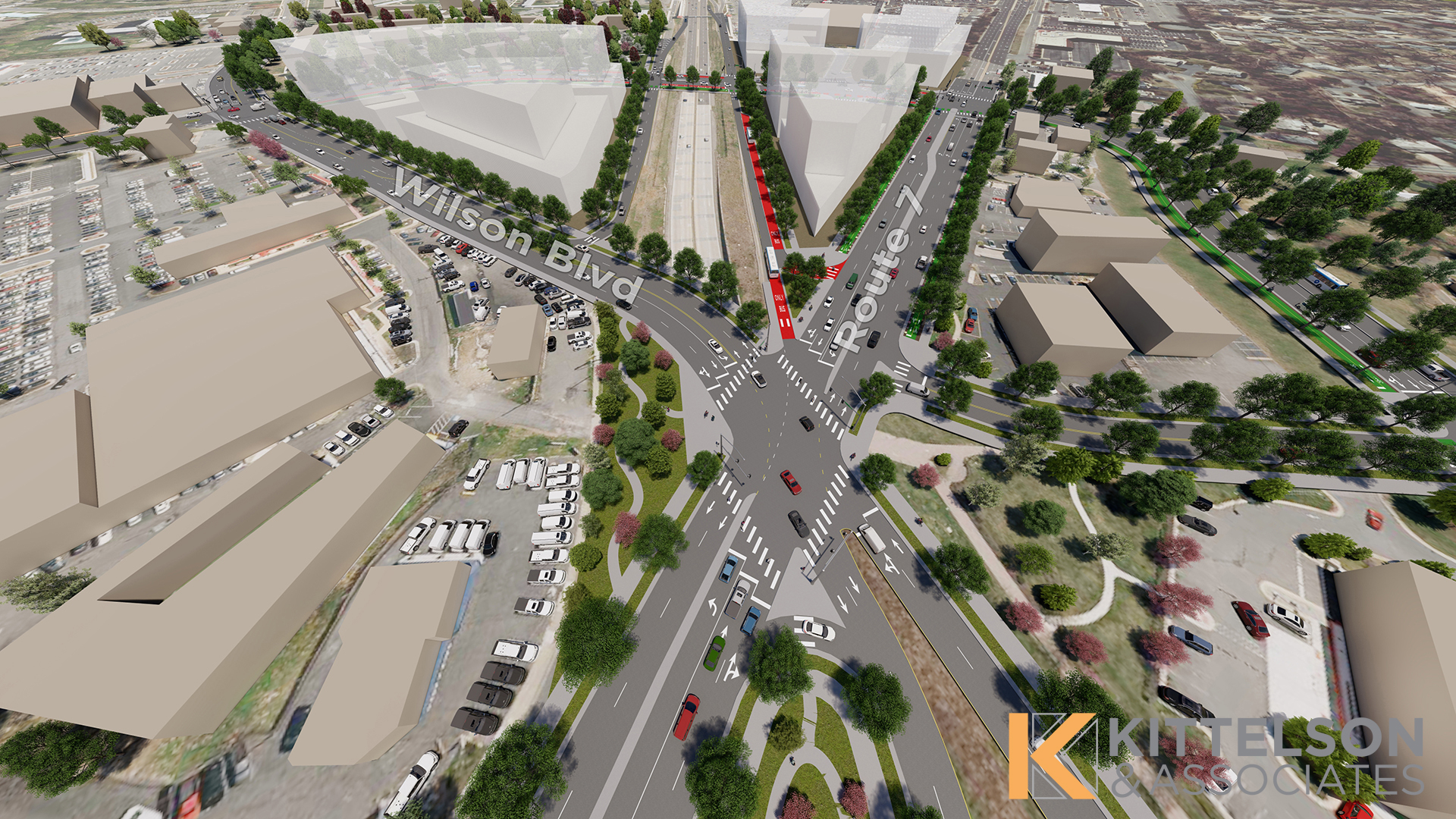
Recent advancements in both hardware and software have significantly enhanced the capabilities of 3D visualization, allowing users to interact in an environment where they can imagine (and appreciate) themselves in the environment before they’re built. One key advancement is the integration of drone photography and photogrammetry to capture images for 3D visualization projects. Drones allow for precise aerial photography, which can be converted into detailed 3D models of project sites. Aerial photography can also be a good reference when modeling a realistic view, or act as the “before” photo in a photo simulation.
Gaming technology has directly influenced the tools we use in the transportation industry, and hardware and software advancements play a crucial role. Hardware innovations of graphics cards and better processing power have revolutionized the way we render 3D scenes. Before these advancements, rendering a two–minute 3D scene with basic graphics could take 18 hours and the use of multiple desktop computers. Now, powerful laptops are equipped to do the same task in much less time. Additionally, cloud environments have further optimized these rendering speeds. Today, most smartphones are capable of running a real-time interactive visualization, making it possible for more immersive visualizations reaching a wider audience.
Software innovations have produced 3D tools with enhanced capabilities that streamline and improve 3D visualizations, lending greater creative power for transportation projects. The advancements in hardware and software enable the creation of more detailed and accurate models, which in turn help transportation projects be more effectively communicated.
💥 Final Boss: Future Trends & Innovations
The future of the transportation industry may be impacted by emerging trends and innovations within the gaming technology and 3D visualization world. New technologies like mixed reality (MR), virtual reality (VR), and digital twins—digital representations of cities or regions complete with buildings, roads, cars, and other elements—may offer even more innovative solutions for transportation planning and public engagement.
MR might allow users to scan a code at a real-world site and visualize the new 3D plan on their phones. This interactive application of MR could become a popular way to show the public new plans in an engaging way, enabling planners another way to further communicate projects to the community.
VR is also set to play a larger role in transportation projects. High–fidelity digital twins create a comprehensive, real–time simulation of urban environments. Digital twins integrate vast amounts of real–world data, making it possible to visualize and analyze the impact of proposed changes. For example, a digital twin of an office space would include the HVAC system, motion sensors, and lighting systems, allowing for detailed planning and optimization. Digital twins could be particularly impactful for things like transportation impact assessments. With a digital twin in place, planners can generate traffic to see the impacts on the intersection and change scenarios based on these impacts.
Innovations in MR, VR, and digital twins facilitate more efficient planning, increased transparency, and interactive public engagement. As these technologies become more accessible and sophisticated, they will lead to more connected urban environments because they empower the user to experience them before they’re required to commit to them. They give officials and the public a more informed understanding of proposed designs, which empowers them as decision-makers and gives them access to the “story” of how the project will change their environment.
Conclusion
The integration of 3D gaming technology into transportation planning represents a significant leap forward, offering new ways for transportation professionals to tell the story of their projects and giving the ability to stakeholders, clients, and the public to experience a project firsthand before it’s even built! 3D visualization helps uncover the unknowns of a project and educate the user about the positive impact the project has in the physical world with more clarity, engagement, and communication.
At Kittelson, we approach new technologies as opportunities, and already we’re finding practical applications for 3D visualization and gaming technology to meet our clients’ needs. As we continue to explore and adopt these technologies, the possibilities for improving transportation systems and enhancing public understanding are virtually (pun intended) limitless.